SamplingEvent
LeeBelbin - Fri Nov 20 2009 - Version 1.12
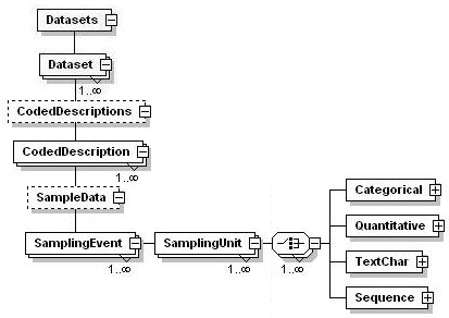
Parent topic: CodedDescription
Main.BDI Part 0: Introduction and Primer to the Main.BDI Standard
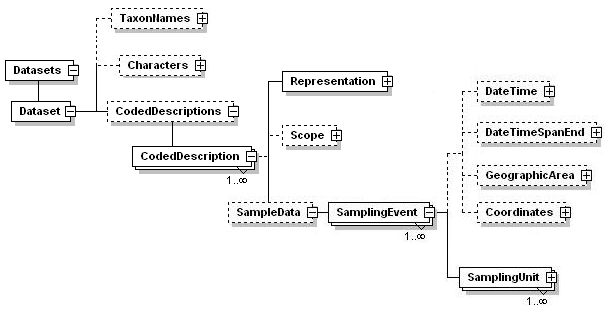
4.5 Elements within <SamplingEvent>
The element <SamplingUnit> contains raw sample data for a specimen. <SamplingEvent> contains information about where and when that sampling occurred.
A simple Main.BDI instance document representing a sampling event has the basic structure shown below and in example 4.5.1.1.
Example 4.5.1.1 - A simple sampling event
|
<DateTime> records the date and time when the sampling event occurred, either as a single time point or as the start of a time period.
<DateTimeSpanEnd> records the end of a time span if event timing is recorded as such. Both date/times may be incomplete in ways not expressible in xs:datetime, e.g. the day and year may be known, but month unknown.
<GeographicArea> is a reference to a geographic area at which the event occurred. This is defined in the element <GeographicAreas> with the basic structure shown below and in example 4.5.1.2.
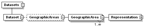
Example 4.5.1.2 Defining geographic areas
|
<Coordinates> records a point on earth at which the event occurred. Elements available are <Latitude>, <Longitude>, <GeodeticDatum>; <Verbatim> (a textual representation of the original location data) and <Literal> (a free-form string in addition to or instead of numeric coordinates (i.e. Charley's Creek, near Chinchilla).
Example 4.5.1.3 Use of the <Coordinate> element
|
4.5.2. SamplingUnit
A sampling unit may be an individual organism, a leaf of a tree, a piece of tissue, etc. In each sampling unit multiple characters may have been observed together ('paired observations'). Example: 'leaf shape, length, and width' of a single leaf). Value frequencies (e. g., '2.3': observed 4 x) are not supported; they are useful when only a single character variable is supported, but complicate paired observations unnecessarily. Char. values with a frequency should be entered in repeated SamplingUnits.
A simple Main.BDI code snippet representing part of the sample data above has the basic structure shown below and in Example 4.5.2.1.
Example 4.5.2.1. Recording sampling data in Main.BDI
|
-- Main.DonovanSharp - 21 Jun 2006